Showing posts with label West Frisia. Show all posts

Sunday, 22 December 2019

Dairy plant 'De Volharding' in Hem

zuivelfabriek
Company envelope sent from Hem on the 6th of November 1949 

The small village of Hem in the southern part of West Frisia established its own dairy plant in the early 1900s to streamline the condition of making cheese and other dairy products in the Zuiderkogge Polder. Farmers who supplied the plant with milk had each their share in the products and profit. The 'Coöp'. abbreviation stands for 'cooperation'. 

Hem fabriek
Dairy plant 'De Volharding' in Hem after it operations  in the 1960s. 

Volharding can be translated as 'perseverance'. The postwar building and especially its chimney still dominate the skyline of Hem in 2019. 

Hem Venhuizen
Juliana 'En Face' tied by a Hem (Noord-Holl.) 'Long Beam' postmark reading 6.XI.49.6.


Hem Venhuizen 1950
Hem and surrounding villages and countryside in the 1950s. The red arrow points to the location of the dairy plant.  

Thursday, 25 April 2019

Grootebroek-Amsterdam 1877

Langstempel
Postcard sent from Grootebroek to Amsterdam. 25th of November 1877. 

Last week I found this postcard in a large box of similar items at the Brievenbeurs in Gouda. I bought it out of regional interest, since the postcard was sent from the village of Grootebroek (5 km east of the town of Hoogkarspel where I live). Although the item was severed on arrival (pinhole in the middle) I still think it makes a valuable addition to my regional collection of Westfrisian postal history.

Wrong postal procedure?

Although my attention was immediately triggered by the name marker of Grootebroek, I took me until today to discover a peculiarity. It seems as if this postcard travelled a rather unusual route, because items from Grootebroek should have been cancelled at the post office in Enkhuizen and not in Hoorn as we see here. So what happened?

Grootebroek
Map of southern West Frisia with Grootebroek below the red arrow, Enkhuizen to the east and the city of Hoorn in the bottom left corner. 

As will be clear from the map above, Grootebroek lies much closer to Enkhuizen than Hoorn and the Grootebroek sub post office would therefore have operated under the postal district of Enkhuizen. There could be two reasons I can think of why we find the Hoorn CDS instead:

  • Difference between the handling of letters and postcards. Stamps on letters from sub post offices should have been invalidated by a 'Puntstempel' (numeral) of its corresponding district. Maybe these rules didn't apply to postal stationary and postcards, thus allowing an item to cross the main post office's district border without been cancelled there?
  • The geographical location of Enkhuizen made it probably very tempting to send items directly to Hoorn as the postal service would have travelled through the villages of Bovenkarspel, Grootebroek etc. anyway. Why bother sending the items to Enkhuizen when there was no need to? It probably seemed as ridiculous to do then as I think of it now.

The village of Grootebroek before the opening of the railway Hoorn-Enkhuizen in 1885.

The last argument seems even stronger when we observe that there didn't exist a railway between Enkhuizen and Hoorn until 1885. The only possible routes to Hoorn from Enkhuizen could either be travelled by boat or by diligence which used the 'Straatweg' (paved road) through Bovenkarspel, Grootebroek, Lutjebroek, Hoogkarspel, Westwoud and Blokker. From Hoorn onwards our postcard used the canalboat or ferry in order to reach Amsterdam: this took about 6 hours. 

Cornelis Pronk
View on the Church and its surroundings of Grootebroek in 1729 by Cornelis Pronk Source: Kerk en Omgeving Grootebroek, door: Cornelis Pronk, Noord-Hollands Archief / Provinciale Atlas, NL-HlmNHA_359_001234_K

Sunday, 31 March 2019

Sarangan (Dutch East Indies) - Westwoud 1937

old postcard
Sarangan - Java


In the years before the devastating Second World War and the Indonesian National Revolution in the 1940s, some previously economically inviable areas of the Indonesian archipelago began to thrive due to Dutch technological innovation in tropical agriculture and forestry. Apart from Java, the other islands (Sumatra, Borneo, Celebes, numerous other small islands and especially the vast area of Dutch Guinea) had previously not been colonized at all. In the 19th century the Dutch governor-general of the Indies was supported by Dutch ‘residents’ who had to supervise the local native rulers, known as ‘regents’. On Java this system worked quite well most of the times, although there were obviously various uprisings throughout its existence. Dutch rule (i.e. supervision) outside Java was less stringent and to a certain degree less important as the other islands couldn't sustain an extensive Dutch bureaucratic apparatus yet.    

This all changed in the early 20th century when spectacular innovations in technology, infrastructure, agriculture etc. reached the Indies as well. Increasing numbers of students at the Technical University of Delft and the National Agricultural College in Wageningen caused recently graduated engineers and agricultural experts to move to the Indies. The cultivation of large area’s outside Java became priority number one: mining of raw material and the cultivation of rubber figs (ficus elastica) was perceived as extremely lucrative.      

The increase of economic activity in the Indies triggered or activated other processes as well: in the Netherlands it was felt that education of children in the Indies should be similar to the Dutch system. Since a lot of Dutch people which moved to the Indies in these years had received some kind of degree back in the Netherlands, they wanted to be sure that their children would receive sufficient education as well. Besides education for European children, the Dutch government accepted an ethical policy in 1901 which had as purpose to stimulate welfare and progress amongst the native people. Education was seen as a key to unlock this process and therefore many schools for Indonesian children opened in subsequent years. I might – unnecessarily – add that the goal of educating every Indonesian child was utopian and thus never reached. In the end only children of the higher ‘regent’ classes received education and then primarily on Java.      

Westwoud
Reverse of the card with address details 


Now we should return to this particular picture postcard. Besides that it captures a fabulous view of the Sarangan mountain, a mountain which attracted many Dutch tourists from the 1930s (below you'll find more information about this place), the sender and especially the address caught my attention when it appeared on my screen online. The card was sent to a certain miss (Mej.: Mejuffrouw) Schaper in Westwoud. This village neighbours Hoogkarspel where I grew up. Apart from this surprise, I was intrigued that before the war and revolt (card was sent in July 1937) someone who was probably related to miss Schaper lived on Java. The people of Westwoud were mainly catholic back then (I know that the Schaper family was for sure) and this collided with my views of the Dutch rule over the Indies. I thought that almost all civil servants, engineers and agricultural experts were of protestant descent. At least I didn’t know anyone from the catholic villages in West Frisia to have moved to the Indies.           

So I went online and to little surprise I discovered that the sender Dirk is in all likelihood the brother of A. Schaper. After some more research I found out that Dirk Schaper had been a teacher on Java! This took away all my doubts who the sender could have been. 

Dutch east indies stamp
Sarangan Typenrader Langebalk (longbeam) postmark reading 7.7.37.10-11V


In 1937 Dirk Schaper (1892-1962) sent this postcard to his sister Aagje Schaper (1889-1965) who then lived in the Halfweg (Halfway) inn. Together with her brother Piet Schaper (1895-1965) and her sister Catharina (Ka) Schaper (1878-1949) she run this inn from 1919 (death of her father) till its closure in the 1950s or ‘60s. The family originally came from the Binnenwijzend (small hamlet south of Westwoud), but their father quit his job as farmer because of his health. As his son Piet Schaper wrote in the Westfrisian chronicle of 1965: “In 1894 kocht mijn vader de herberg. Hoi was boer in Binnenwoizend, maar deur tongblaar, longziekte, varkenspest en houge huur en drougte kon dat niet langer. Nei m’n vaders dôôd in 1919 bin ik kasteloin worren en dat bin ik nou nag…(Translation: "My father bought the inn in 1894. He was a farmer on the Binnenwijzend, but because of footh-and-mouth disease, lung disease, swine fever, high rent and drought he wasn’t able to continue. After his death in 1919 I became innkeeper and that’s my job still…").


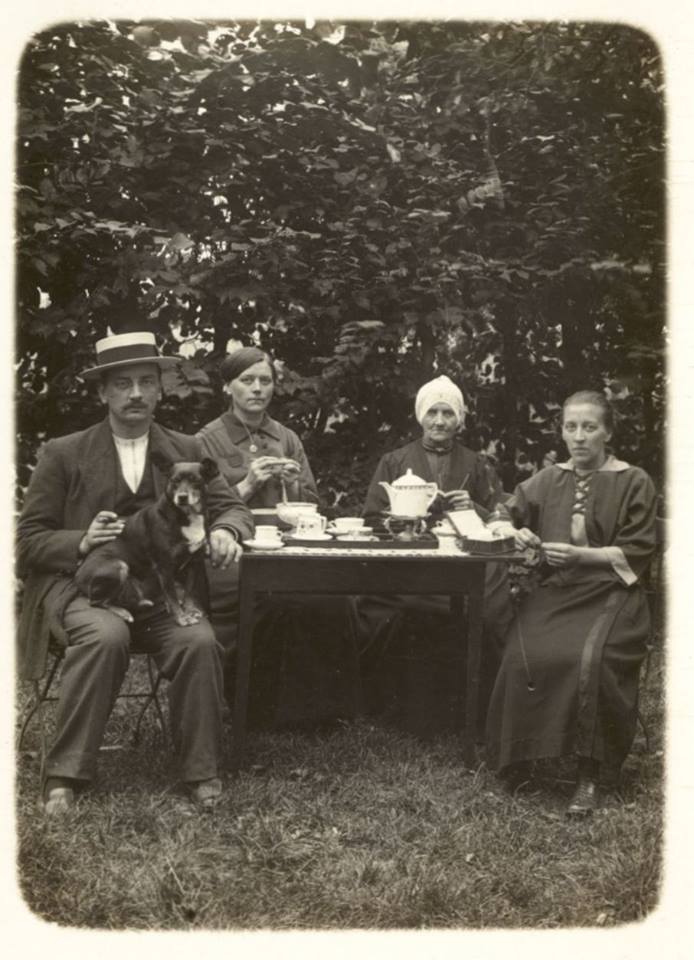
Schaper family of the Halfweg Inn in Westwoud: f.l.t.r. Piet Schaper, Ka Schaper, Mother Schaper (Maartje Snip) and Aagje Schaper (receiver of our postcard). © Het Geheugen van Westwoud

My father pointed out that Dirk, Aagje and all other Schaper family members are related to me. The grandmother of my great-grandmother Maartje van der Gulik (1897-2000) was called Maartje Schaper (1842-1915). Subsequently her grandfather was called Sijfert Schaper (1779-1829). Sijfert Schaper is our common ancestor. So after all, this philatelicly not so interesting postcard has proved to be an extraordinary postcard history- and familywise!

Café Halfweg (Halfway Inn) with allegedly father Dirk Schaper in the doorway. Picture taken in 1918 or 1919 since the rails of the famous horse-drawn streetcar had already been removed (service stopped on the 31st of December 1917). Father Dirk Schaper passed away in 1919. 

Sarangan 

Dirk Schaper stayed in Sarangan in July 1937 and I think it's likely he enjoyed his holidays there. From the early 1920s on Dutchmen gradually found there way to this hidden gem, located on the green eastern slope of the Lawu volcano thus basically being isolated from western Java. It took until 1937 before a road was opened from Sarangan to the west. And only 10 years earlier the last kilometers from the town of Magetan to the east were only accessible by horse or foot. No easy place to reach. Which raises a question: why were the Dutchmen and other Europeans so eager to come to this mountain lake? The following Dutch account might give you the answer:

“Toen de bestuurder de auto aan de voet van het hotel tot stilstand bracht, aanschouwden wij voor het eerst het meer van Sarangan. Veel hebben wij gereisd: door China en Japan, door Amerika, door de Europese Alpen, genietende van de schitterendste natuurtaferelen. Van dít oord kunnen wij echter verklaren dat het door zijn schoonheid, zijn liefelijkheid, zó’n wondere indruk op ons maakte dat we onszelf beloofden, hier onze vakantie eens door te zullen brengen. [….] Sarangan, met zijn meer, zijn eilandje, zijn omringende heuvelen en bossen, is voor ons een openbaring geweest.”

"When the driver parked the car right on the curb of the hotel, we saw the lake of Sarangan for the first time. We've travelled a lot: we've been in China and Japan, in America and the Europeans alps, enjoying the very best of nature. We could state of this place though that due to its beauty and sweetness it made such a marvelous impression on us that we promised ourselves to celebrate our holidays here once. [....] Sarangan, with its lake, its islet, its surrounding hills and forests proved to be a revelation for us."  

Besides its stunning location, natural swimming pool and lush forests, one distinct feature lured many Europeans to the resort: its cool climate. At 1500 meters above sea level they could cool down there overheated bodies in the lake and its surrounding rain forests. A truly European refuge. 

Sarangan - view to the northeast

Sunday, 6 January 2019

Happy New Year - 1914

Gelukkig Nieuw jaar
Happy New Year!
While browsing through my collection, I stumbled upon the embossed Happy New Year postcard above. A proper reminder for me to convey you all my - now belated - best wishes for 2019!

Although the picture postcard itself seems philately wise quite irrelevant, it suits my West Frisia collection nicely since it bears the postmark of the town of Hoogkarspel:

Postmark
Large round postmark of Hoogkarspel, reading 31 DEC 13 on 1c Vürtheim
Since the sender chose to apply a 1c stamp (printed matter rate) she wasn't allowed to write anything on the card apart from the address. She did cheat however by discretely placing her name under 'Bovenkarspel': T. Broers. After some research online a very respected genealogist found a certain Catharina Broers who lived in Hoogkarspel in these years. In the West Frisian dialect the catholic name of Catharina is often abbreviated to Trien or Trijntje, hence the 'T'. She was the daughter of Cornelis Broers and Aaltje Neefjes and married with Nicolaas Koopman in 1917 at age 23.


Postmark
Reverse of the postcard
New Year 1914 was quite chilly, temperatures did hover around freezing. Frederik van Eeden, a famous Dutch author added to his diary on the 1st of January: "Stil, matig vriezend weer." Tranquil weather, moderate frost. January 1914 turned into a below average cold month in the Netherlands: from the 10th until the 25th people had to cope with a period of frost with an average temperature of -3°C. Compared to today's Dutch standards: extremely cold. Alas, the period fell only one day short for a 3rd Elfstedentocht to be organized. 

A tumultuous year

We all know now that 1914 didn't turn in a happy year at all, although the Netherlands did escape the bloody consequences of the assassination of Archduke Franz Ferdinand. The town of Bovenkarspel and its hamlet Broerkerhaven, situated in West Frisia (Holland) probably didn't witness even one of the approx. 1 million Belgian refugees who fled their country after Germany had successfully occupied it. It really was (and still is) on the edge of the country, far from every border.

1914
Map of the upper part of the province of Noord-Holland, the protruding part (the 'Nose') is the eastern part of West Frisia. Bovenkarspel below the red arrow. 


Hoogkarspel-Broekerhaven

The actual route the postcard travelled was not very exiting: from the town of Hoogkarspel the postcard could either have made the journey by rail or by tram taking the old route through the various villages of the 'Streek'. In Dutch 'streek' means a region, or part of a country. The Streek is the long road (already paved in 1671) between the VOC cities of Hoorn and Enkhuizen. Since the villages between these cities were of vital importance for the people living and working there, a good quality road was deemed essential. Many people who lived alongside the paved road benefited from this fast connection to Hoorn and Enkhuizen and therefore local trade flourished. In 1889 a horse drawn tram was introduced, but the dawn of motorized traffic turned the tram into an old-fashioned and eventually superfluous means of transport. Services ceased in 1918.

The route between Hoogkarspel and Broekerhaven over the Streekweg in red. To the left we see the once proud city of Enkhuizen, large parts of it were demolished after 1800 because of Napoleon and consequently decreased trade flows.  
The card was addressed to Catharina Botman, probably a daughter (or wife) of Willem Botman. It's a rather strange since mej. (mejuffrouw) is the form of address used for unmarried girls in Dutch and therefore the equivalent of the English miss. But in 1913 Catharina Botman was already married to Willem for a long time, so maybe this card was addressed to her daughter with the same name. By sheer chance Catharina's own family name was also Botman, so she was called Catharina Botman-Botman.  


Transport over water

Willem Botman was trained into a special trade, that of schuitenpik. Schuitenpikkers build so-called schuiten (Dutch barge or schuyt), which are the type of flat-bottom ships farmers and agrarians used in West Frisia and other parts of Noord-Holland to bring e.g. cattle to and fro their lands in the wet polder area's. You only have to look at the map above to see that most of the fertile lands were inaccessible by foot, everything had to be transported over water. You'll find more about Westfrisian agriculture here

Schuitenhelling (barge ramp) of the Botman family in Broekerhaven. The third person from the right is Willem Botman (1865-1929),  the fourth person from the right is his wife Catharina Botman (1870-1954) to whom the postcard could have been addressed. Copyright and courtesy of Historische Vereniging Stede Broec. 

Two schuyts entering the city of Enkhuizen with one of them carrying a tractor. © Collectie Rijksdienst voor het Cultureel Erfgoed, F002889 

This all changed as late as the 1960s when the polders were 'verkaveld', which means that the land and numerous ditches were straightened, raised and filled. At the same time new roads were introduced to make this vast area accessible for motorized vehicles. I do not have to stress how this process literally wrecked the unrivalled beauty of West Frisia, particularly ruining the Streek region.
       
PS I've added three - I think - relatively contemporary photo's which were taken along the route the postcard travelled. Could you guess where exactly the pictures were taken?

Hoogkarspel autochrome
Hoogkarspel approx. 1907-1915. Autochrome photograph of a freshly painted West Frisian farm (Stolp) in the early 1900s, before the introduction of electricity. The tram rails laid claim on the southern part of the Streekweg, so the photographer looked to the west.   
Catholic Church Netherlands
Spire of the Catholic Church of Bovenkarspel (now demolished) and the tram rails (removed in 1924). © Collectie Rijksdienst voor het Cultureel Erfgoed, BR00885-81357 

Railway crossing Netherlands
Railway crossing Broekerhaven. © Collectie Rijksdienst voor het Cultureel Erfgoed, BR00883-81355

Thursday, 13 September 2018

The West Frisian Dialect


Wervershoof 30-05-1913. Mrs Maartje Hooijveld-Mantel sends a postcard to her niece who lives in the neighboring village of Andijk:


~
"Efrouw!

Hiermede bericht ik u dat a.s. zondag P.B. komt, dus verwacht ik later bericht van u. Warm wéér te schoonmaken Ant! maar op bloote benen in de klompen

Nahartelijke groete

M. Mantel-Hooijveld"

~

 In English:

~
"Efrouw!

Herewith I let you know that P.B. will visit me this Sunday, so I expect you to inform me soon. Warm weather to do cleaning Ant!, on bare feet (legs) in our wooden shoes it is then.

Wit kind regards,

M . Mantel-Hooijveld"
 ~

The postcard is somewhat stained, so the true reason I bought this was the message it contains. Especially the last 'cleaning'- sentence sparked my interest:

"Warm wéér te schoonmaken Ant! maar op bloote benen in de klompen"It is written in 'pseudo' West Frisian, to be precise the dialect variant of the Dutch language, not the one labelled as language and which is spoken in the province of Friesland across the IJsselmeer.

A short piece on this dialect can be consulted on Wikipedia: https://en.wikipedia.org/wiki/West_Frisian_Dutch but alas there is no grammar available for English readers, so I will show you a couple of linguistic phenomena typical of West Frisian from the handbook "Hé, is dat Westfries?" by the great H. Langedijk:

Different conjugation of irregular verbs
Dutch: helpen, hielp, geholpen
West Frisian: helpe, holp, holpen
English: help, helped, helped

A peculiarity of West Frisian is the absence of the 'ge'-prefix for the present perfect: so, "holpen" instead of "geholpen"

Another one:
Dutch: hangen, hing, gehangen
West Frisian: hange, hong, hongen
English: hang, hung, hung

Different auxiliary verbs
Dutch: Jij bent niet mee geweest.
West Frisian: Jij hewwe niet mee weest.
English: You haven't come/'been' (with us).

In West Frisian the auxiliary verb of 'to be' = a form of 'hebben' (hewwe) and not 'zijn' (bent) as in Dutch. It sounds very odd if you're not from West Frisia and would be the equivalent of replacing the English 'haven't' with 'wasn't': 'You wasn't come with us'...

The real surprise, if you have been paying close attention, is the fact that English uses the auxiliary verb 'to have' for the present perfect 'been' as in West Frisian but unlike the Dutch 'to be'.

Vocabulary
Enough grammar for now, since the real reason why West Frisian is such a fun language to learn results from its vocabulary and proverbs. It is well-known Frisian is more closely related to English than Dutch and therefore West Frisian has some conspicuous anglophone words as well which are non-existent in Dutch: e.g.
Dutch: Schemerig
West Frisian: Tweilichtig
English: Twilit / dusky

Other wonderful West Frisian expressions (some derive from older Dutch or French words, but other are definitely 'original' and very creative):

Dutch: 't Is mistig.
West Frisian: 't Is moordenaarsweer.
English: It is foggy [murders' weather].

Dutch: Dat was een welkome verrassing.
West Frisian: Dat was in de emmer.
English: That was a pleasant surprise [That was in the bucket].

Dutch: Hij keek erg teleurgesteld.
West Frisian: Z'n lip hong op 't onderste knoupsgat.
English: He looked very disappointed [His lip had fallen to his undermost buttonhole].

Dutch: Daar komen van die hooghartige dames aan.
West Frisian: Deer komme van die grooske tieten an.
English: Those arrogant women are approaching [those arrogant tits are approaching].

Now the grand finale: a proverb which is said of lazy and/or tired people:

West Frisian: 'Louf? Louf ken lang an: eer je biene bai je kniese of benne kèn je nag zestien jaar te wortelewuden nei de Langedoik.
English: Tired? Fatigue can take a long time: before your legs have been worn up to your knees, you're still able to weed amid the carrots in Langedijk for sixteen years.

There you have it: a small introduction to West Frisian because of Maartje Mantel's:


"Warm wéér te schoonmaken Ant! maar op bloote benen in de klompen"
Although she tried to make her West Frisian more Dutch, she made one mistake: to place the essential subordinating conjugation 'om' before the 'te': het is warm weer om te schoonmaken'. But overall, she did a good job: she didn't wrote 'skoonmaken' instead of the Dutch schoonmaken (to clean) and she didn't wrote 'biene' for the Dutch 'benen' (legs).


Large round postmark of Wervershoof on a ¢2½ Vürtheim stamp

The decline
Already in 1913 West Frisians seemingly wanted to speak and write as 'normal' Dutch (whatever that means...). After WWII when the Netherlands prospered and West Frisians could afford study and travel, they tried even harder to ban West Frisian because you made yourself look ridiculous in company of more decent people (from Haarlem, The Hague, Utrecht etc.). The rise of television didn't help much either to preserve the language.
Nowadays you could still hear some reminders of the West Frisian dialect in people's tongue. Especially the melodious aspect of it and the 'wrong' pronunciation of the sch- as in Schaatsen (Ice-skating) which becomes 'Skaatsen' is something difficult to get rid of. But the true soul of the language: the vocabulary, typical expressions and grammar have sadly all become something of the past.

Typenrader arrival 'Langebalk' postmark of the neighbouring village of Andijk 

Thursday, 7 June 2018

Dotted Crown (2): the Muiderslot

Muiderslot in Muiden around 1920 
In my previous post I talked about the quirky Haarlem postmark on this postcard, but now it is time to have a look at its front.

Recently dubbed 'Amsterdam Castle' to lure tourists away from the overcrowded Amsterdam streets, the Muiderslot (slot = castle in Dutch) in the small town of Muiden is one of the most valued monuments in the Netherlands. To actual location of Muiden is on the shores of the former salt Zuiderzee (Southern Sea), which became the shallow IJsselmeer after the Afsluitdijk was constructed in 1932. A contemporary map shows you the exact location of Muiden with regard to Amsterdam:

Muiden south of the red arrow, Amsterdam lies to the left

The castle was built around the end of the 13th century by Count Floris V. Earlier the location of the castle was used by Floris to invade West-Frisia to the north (the protruding 'nose-shaped' piece of land on the the card above) after a devastating flood in 1288 which paralyzed the West-Frisians. Floris took advantage of this situation and concurred us (I am from West-Frisia), by building some imposing strongholds. Legend has it that Edward I of England helped Floris from his own castle building experiences in Wales. Ever since we're fettered, but we did well out of it!

Floris was captured and eventually killed in 1296 by Gijsbrecht of Amstel and Gerard van Velsen. 

Then a messy period started (14th century) and some reports state that the castle was demolished before being resurrected again at the end of the 14th century. We don't know for sure however.

In the 17th century the castle was occupied by the bailiff P.C. Hooft, whose real merits are his poems and plays. Together with important literary figures as Huygens, Vondel and Bredero he reportedly created the 'Muiderkring': a group of artists which regularly met at the castle. 

A feast at the Muiderslot with members of the Muiderkring by Louis Moritz
After the death of P.C. Hooft the castle became derelict. When the French troops arrived they used the castle as a barrack which probably caused even more damage to the castle. In the 19th century the Dutch government wanted to sell the castle for demolition, but King William I objected. By a small miracle the castle was saved on request of historian Samuel Wiselius. The initial idea was to let the castle fall into disrepair to create a romantic ruin. Luckily this didn't happen. When the interest in our national history increased again by the end of the 19th century, the government appointed Pierre Cuypers to rebuild the castle. Due to the lack of archaeological and architectural research available, he made the castle look a bit fantastic when the restorations was done. In a subsequent restoration certain additions Cuypers was responsible for were made undone again. 

The Muiderslot prior to the first restoration by Cuypers (1886).

      
The Muiderslot after the first restoration by Cuypers (after 1895)


The Muiderslot in 2017


Oily forwarding mystery - Delft to Port Swettenham via Babo

Newspaper wrapper sent from Delft 17-1-1938 via Pladjoe and Babo to Port Swettenham via Singapore (4-6-1938) The newspaper wrapper shown abo...