 |
| Happy New Year! |
While browsing through my collection, I stumbled upon the embossed Happy New Year postcard above. A proper reminder for me to convey you all my - now belated - best wishes for 2019!
Although the picture postcard itself seems philately wise quite irrelevant, it suits my West Frisia collection nicely since it bears the postmark of the town of Hoogkarspel:
 |
| Large round postmark of Hoogkarspel, reading 31 DEC 13 on 1c Vürtheim |
Since the sender chose to apply a 1c stamp (printed matter rate) she wasn't allowed to write anything on the card apart from the address. She did cheat however by discretely placing her name under 'Bovenkarspel': T. Broers. After some research online a very respected genealogist found a certain Catharina Broers who lived in Hoogkarspel in these years. In the West Frisian dialect the catholic name of Catharina is often abbreviated to Trien or Trijntje, hence the 'T'. She was the daughter of Cornelis Broers and Aaltje Neefjes and married with Nicolaas Koopman in 1917 at age 23.
 |
| Reverse of the postcard |
New Year 1914 was quite chilly, temperatures did hover around freezing. Frederik van Eeden, a famous Dutch author added to his diary on the 1st of January: "
Stil, matig vriezend weer." Tranquil weather, moderate frost. January 1914 turned into a below average cold month in the Netherlands: from the 10th until the 25th people had to cope with a period of frost with an average temperature of
-3°C. Compared to today's Dutch standards: extremely cold. Alas, the period fell only one day short for a 3rd Elfstedentocht to be organized.
A tumultuous year
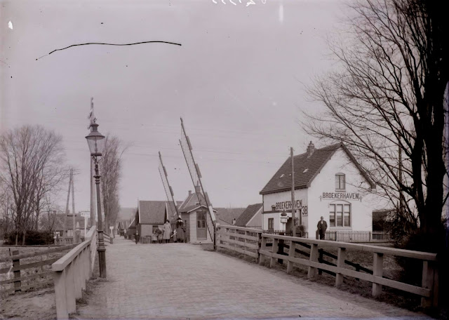
We all know now that 1914 didn't turn in a happy year at all, although the Netherlands did escape the bloody consequences of the assassination of Archduke Franz Ferdinand. The town of Bovenkarspel and its hamlet Broerkerhaven, situated in West Frisia (Holland) probably didn't witness even
one of the approx. 1 million Belgian refugees who fled their country after Germany had successfully occupied it. It really was (and still is) on the edge of the country, far from every border.
 |
| Map of the upper part of the province of Noord-Holland, the protruding part (the 'Nose') is the eastern part of West Frisia. Bovenkarspel below the red arrow. |
Hoogkarspel-Broekerhaven
The actual route the postcard travelled was not very exiting: from the town of Hoogkarspel the postcard could either have made the journey by rail or by tram taking the old route through the various villages of the 'Streek'. In Dutch 'streek' means a region, or part of a country. The Streek is the long road (already paved in 1671) between the VOC cities of Hoorn and Enkhuizen. Since the villages between these cities were of vital importance for the people living and working there, a good quality road was deemed essential. Many people who lived alongside the paved road benefited from this fast connection to Hoorn and Enkhuizen and therefore local trade flourished. In 1889 a horse drawn tram was introduced, but the dawn of motorized traffic turned the tram into an old-fashioned and eventually superfluous means of transport. Services ceased in 1918.
 |
| The route between Hoogkarspel and Broekerhaven over the Streekweg in red. To the left we see the once proud city of Enkhuizen, large parts of it were demolished after 1800 because of Napoleon and consequently decreased trade flows. |
The card was addressed to Catharina Botman, probably a daughter (or wife) of Willem Botman. It's a rather strange since mej. (mejuffrouw) is the form of address used for unmarried girls in Dutch and therefore the equivalent of the English miss. But in 1913 Catharina Botman was already married to Willem for a long time, so maybe this card was addressed to her daughter with the same name. By sheer chance Catharina's own family name was also Botman, so she was called Catharina Botman-Botman.
Transport over water
Willem Botman was trained into a special trade, that of schuitenpik. Schuitenpikkers build so-called schuiten (Dutch barge or schuyt), which are the type of flat-bottom ships farmers and agrarians used in West Frisia and other parts of Noord-Holland to bring e.g. cattle to and fro their lands in the wet polder area's. You only have to look at the map above to see that most of the fertile lands were inaccessible by foot, everything had to be transported over water. You'll find more about Westfrisian agriculture here.


No comments:
Post a Comment